PINE RIDGE INDIAN RESERVATION
The Pine Ridge Indian Reservation is larger than the states of Delaware and Rhode Island combined and is home to the Oglala Lakota people. It is an area of raw beauty, rich culture, and extreme economic hardship. The tribal government is located in the town of Pine Ridge, the Oglala Community College is a few miles SW of Kyle, and Lakota Friends Circle is headquartered in Wanblee. Wounded Knee is the site of the massacre that took place in 1890.
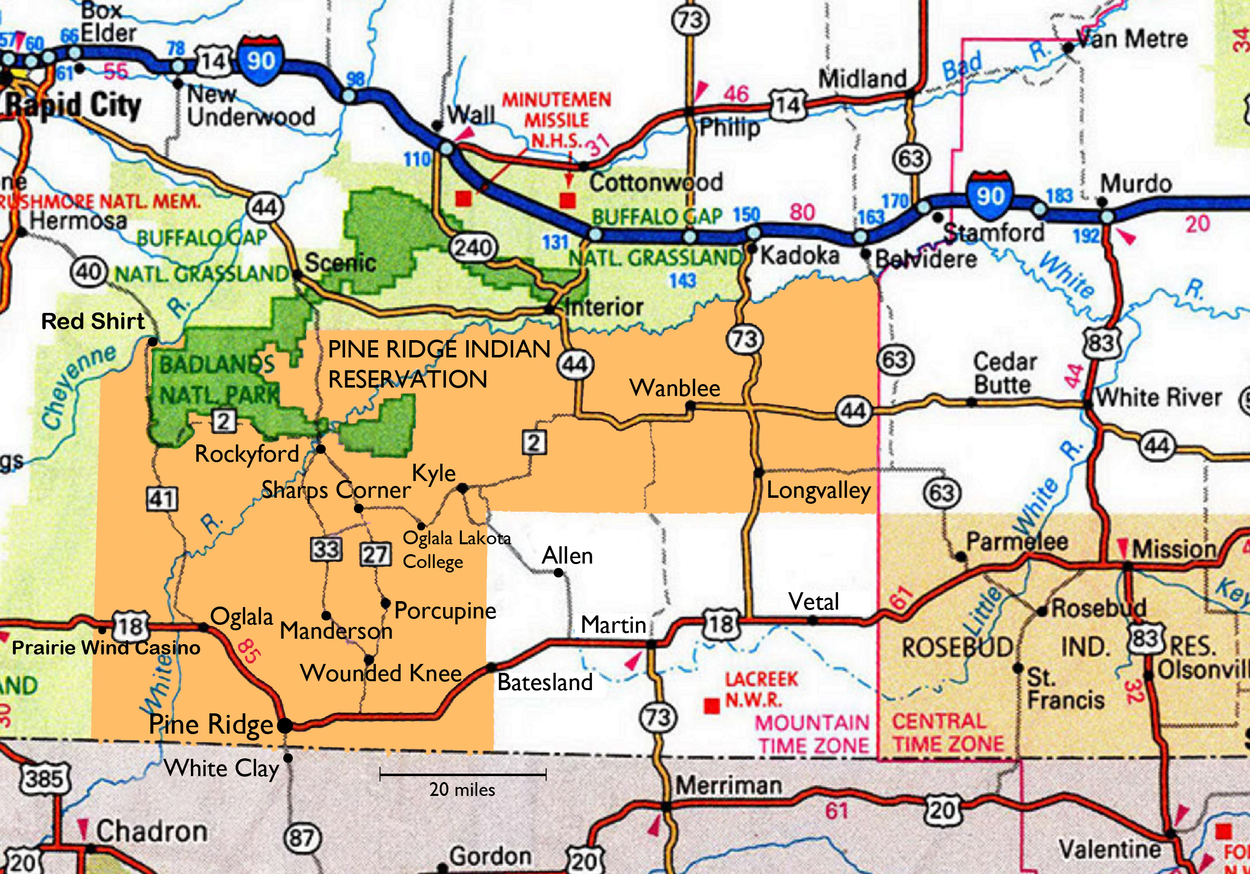
In addition to the main Reservation which is shown in orange, there are also pockets of trust and tribal lands in the SE quadrant (colored white). These areas in and around Allen, Martin, and other places are also part of the Reservation.
Pine Ridge covers a huge area with large distances between communities. For example it is about 100 miles between Oglala in the SW corner and Wanblee in the NE segment. It is a similar distance from the town of Pine Ridge to Rapid City, the nearest city in South Dakota. Many residents do not have the money to buy gas even if they are lucky enough to own a functioning vehicle. Public transportation is extremely limited.